<< Station 1 | Back to industrial trail | Station 3 >>
Measuring the groundwater level
Groundwater is the underground water that fills all the cavities in the earth’s surface, such as pores or clefts. This water is moved by gravity or by friction. Ground water is subject only to the laws of gravity. It flows horizontally through the subterranean cavities.
The surface of the groundwater is called the groundwater table. Above this is the capillary seam. This moisture is retained in the ground by adhesion and capillary effects that counteract the earth’s gravity. Plants derive their nutrition and water from this zone.
The aquifers for ground water are rocks, either in loose forms (sand, gravel) or in firm ones (granite, chalk); the series of cavities in them are large enough for water to flow through. Rocks with very small or unconnected pores (clay) stop the flow of ground- water. The flow rate of such groundwater varies greatly. In sand, it is one metre per day, in rubble, 5-20 metres per day; in rocks with many clefts, it can increase to more than 100 metres per hour (standard values). Groundwater either flows into a so-called receiving water course (river, lake) or comes to the surface as springs.
Surface water, such as flowing water or ponds, is often very closely connected with ground water. In dry periods, especially, groundwater supplies streams and rivers with water and thus prevents them from drying out.
Groundwater
The chief aquifers in the Hirschau – Schnaittenbach Valley are Triassic sandstones. The direction in which groundwater flows here was determined long before mining began, when the layers of rock fell in a north-easterly direction.
As a result of the subsidence due to clay-mining, a funnel has formed in the area immediately beside the open-cast pits. The water level here is as much as 65 metres lower than the original groundwater level. Naturally, this affects the surface water as well as the flora and fauna.
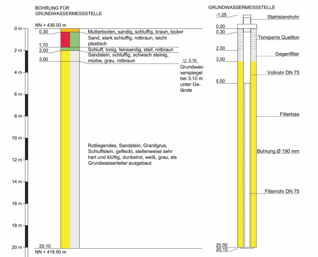
By means of a measuring-point, it is possible to monitor the level and the quality of the ground water. Here, the water level is measured by using a Lichtlot (electric contact gauge) and Drucksonden (pressure gauges). Over the whole of the mining district, there are now 40 points where groundwater is measured, so that observations can be recorded over a period of years. The groundwater level rises in years when there is heavy precipitation and falls in years of low precipitation. The groundwater level at this measuring-point varies between 6.2 m and 1.8 m below the surface.