Skip to content
GeoPark Kaolinrevier Hirschau – Schnaittenbach r.A.
Menu
  • Home
  • Audioguide
  • Contact
  • Imprint
  • Data protection
  • Cookies
  • cs_CZ
  • de_DE

Industrial Trail

https://www.geopark-kaolinrevier.de/wp-content/uploads/2018/geopark_en.mp3

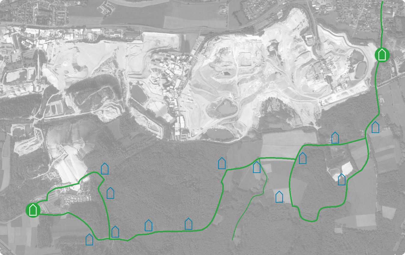
The infopoints on the industrial trails
The Industrial Trail has 14 Stations and begins at the foot of Monte Kaolino in Hirschau, although visitors can also set out from Schnaittenbach, since the Trail follows a circular route.

Station 1: Introduction, the GeoPark project, geology, mineral deposits, products

Station 2: Measuring groundwater levels

Station 3: Restoring streams to their natural state

Station 4: The forest, the quarrying of mineral ore and the smelting of iron in Eastern Bavaria in prehistoric and primeval times

Station 5: The forest, its water, the quarrying and smelting of iron ore in the late meiaeval and early modern periods

Station 6: Traditional woodland trades Charcoal-burning, resin-gathering, the harvesting of wild honey

Station 7: Safeguarding reserves, landscape and vegetation

Station 8: Yesterday – Today – Tomorrow. The development of the kaolin mines from the earliest times to the present-day. The post-industrial landscape. Environmental protection and sustainability.

Station 9: Processing kaolin in the past (the ‘Faberschlemm’) and in the present.

Station 10: A Cultural Landscape – the Hirschau – Schnaittenbach District

Station 11: Sedimentation ponds: the natural way of cleaning used water

Station 12: The Kaolin Mine in 2006

Station 13: Krausöd Quarry, an important geotope

Station 14: Measuring the outflow from the Weitzendorf Stream

This project is co-financed by the EU.


Sponsors:

Sponsos of the project Geopark Kaolinrevier


Distinction:

E.ON Umweltpreis für den Industriepfad I im Jahr 2005

Events

  • In the Valley of White Earth
  • KunstGipfel – ArtSummit
Copyright © 2018 – Kaolinrevier Hirschau - Schnaittenbach e.V.
WordPress Cookie Notice by Real Cookie Banner